Technologies has made navigation across the ocean easier and simple. The more we live the more we see high modified technological innovations coming. Gone are days when a navigation officers has to spend hours planning for voyage, drafting out maps, etc.
It’s quite understood that the ship navigation has been fraught with danger ever since the first vessel took to the sea, but today it’s more less risk for ship crews to sail around the world, even at the deepest oceans.
Related read: How to maintain good Watchkeeping onboard ship
However, as the new ship navigation appliances comes into conventions, it’s important for the navigation officers to have more knowledge of the latest equipments, and be more familiar on how to use them. Some might be sailing onboard old ships built in 90’s but with articles like this, where people share ideas and enthusiasm, it’s better to ask more questions for a better understanding. Haven said that, let’s point out list of modern navigation equipments to be found onboard vessels of today.
Types of Modern ship’s Navigation Equipment
Based on my experience and researches made, there are more 50 modified types of navigational equipments which can be found onboard ocean going vessels today. Among them are:
- Voyage Data Recorder (VDR)
- Rudder Angle Indicator (RAI)
- Range Tracking and Identification (LRTI),
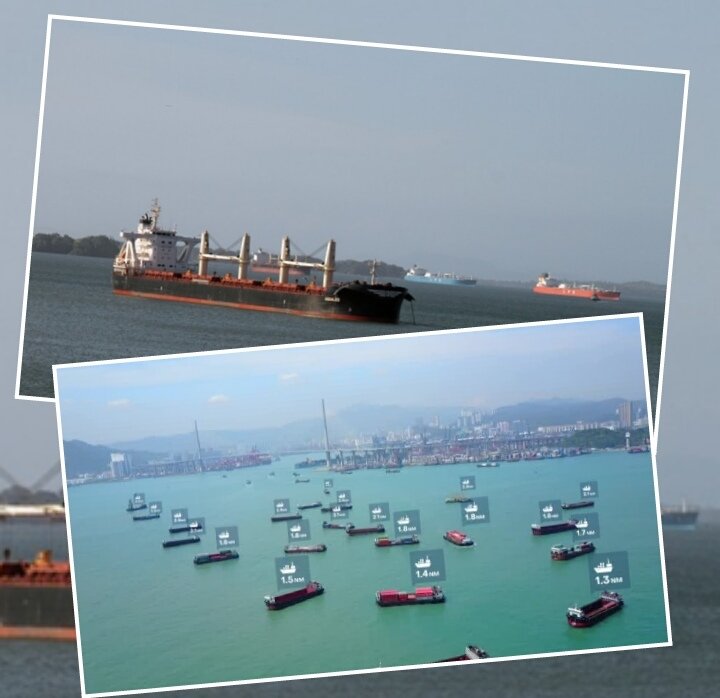
- Orca AI ( a new navigation system which offers increased sight in the toughest conditions – it uses deep learning artificial intelligence algorithms)
- Magnetic Compass (SMC)
- Gyro Compass ( Still available for a while but modified)
- long active Radar,
- Automatic Radar Plotting Aid (ARPA – which displays the position your ship and other vessels nearby)
- Speed & Distance Log Device (SDLD – to help you measure your ship speed and the distance covered from a particular set point. For me I call it ETA made easy)
- Electronic Chart Display
- Information System (ECDIS – for me I call it point and go. 2nd officers can just pinpoint locations and attaining directions will be given),
Also, see Ship navigational appliances and it usage
- Automatic Identification system (AIS – This uses VHF radio channels as receivers and transmitters to receive and transmit messages between ships and shore)
- Auto Pilot (This actually makes lots of navigators lazy. But helpful to humans at sea by controlling the ship automatically from a set point to another)
- Global Positioning System (GPS – it uses Global positioning satellite, to transmit information like ship speed, location, etc.)
- Echo Sounder (One of the oldest technology for ship navigation, it’s used to measure the depth of the water under the ship’s bottom using sound waves technic)
- Rate of Turn Indicator (RTI – it measures the rate in which ship turns, best use during pilotage), etc.
While the number of vessels continues to grow year by year, costal and sea ways becoming congesting and difficult to navigate. Therefore the introduction of the “Orca AI” was quite a useful one for navigators. It not only reduce the numbers of ship collision (in areas like Singapore, Panama, and other busy ports) but save insurance companies from daily calls from ship owners for damages caused by collision.
How Orca AI works?
With the modern VLCC, Containers ships, passenger ship, war ships, etc. It’s difficult to navigate in congestion areas without placing humans around for watch out. Sometimes human errors may occur, mostly when you placed unexperience fellow right on the corner where he or she will not perform what require.
Read more on : 25 Navigation exam question and answers you may like to know.
According to the manufacturer function introductions, ” it’s been integrates with systems already on board, adding additional sensors such as thermal and low-light cameras which feed information into an AI-powered navigation system. Together, they provide long-range visibility in any lighting or weather condition.” It also has the capability to detect, identify and track multiple vessels at any one time.
Furthermore, with this navigational technology, it’s more easier for pilots and Captains to navigate within busy areas. Adding to the manufacturers statement, they said Orca AI uses “deep learning artificial intelligence algorithms” to identify and classify vessels on the water, providing “life-saving alerts” and avoiding ship collision.
Probably this is one of the useful equipment next to radar, it functions becomes more active than that of radar. It’s quite unfortunate that this came after I have left VLCC ships.
More navigation equipments to be added to this post. Subscribe below for updates and newsletter.
Like this article? Share the knowledge with friends and drop your questions or contributions to below discussion box.
Also, Don’t forget to subscribe below for updates and newsletter.



3 thoughts on “New Modern Technology for Ship Navigation”
Pingback: Navigating the Truth: Unraveling the Mystery of Waze’s Compass Feature – PrecisionOutdoors
Pingback: Installing GPS Maps in Your Maserati CD Player: A Step-by-Step Guide – OsVehicle
Pingback: The History And Purpose Of Lighthouses – Twin Lights Light House